The first internet resource I would recommend to anyone who is interested in the history of South Korea or any information about South Korea in general is http://www.koreaaward.com/kor/index. From here you can find out about the history of South Korea, broken into periods to find the information easier, to everything else from maps, images, geography, news, and they even have information on the flag and national flower. This makes the website one of the most extensive that I have seen and I have a feeling I will be using this website a lot for this class.
The second internet resource I found useful is lonely planet found at www.lonelyplanet.com/south-korea. This website is useful for the history of South Korea, broken up into eras as well, to work and study, places to go, weather, and other information. If you go to the main lonely planet page you can find other countries as well.
The second internet resource I found useful is lonely planet found at www.lonelyplanet.com/south-korea. This website is useful for the history of South Korea, broken up into eras as well, to work and study, places to go, weather, and other information. If you go to the main lonely planet page you can find other countries as well.
Byeongju, P. (2010, September 23). Gojoseon. In byeongjupark. Retrieved July 13, 2015, from https://byeongjupark.wordpress.com/article/gojoseon-2zvfgrgyend5c-5/
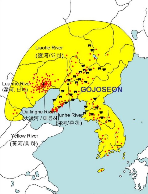
This map shows the original Gojoseon as founded by Dan-Gun in 2333 B.C.E. The capital was in current day Pyongyang in North Korea. As you can see the areas that are more condensed are formed near the rivers, allowing for more farms.
Visit Exotic Asia. (2010). Climate of Korea. In Visite Exotic Korea. Retrieved July 13, 2015, from http://www.visitexoticasia.com/korea/climate.html
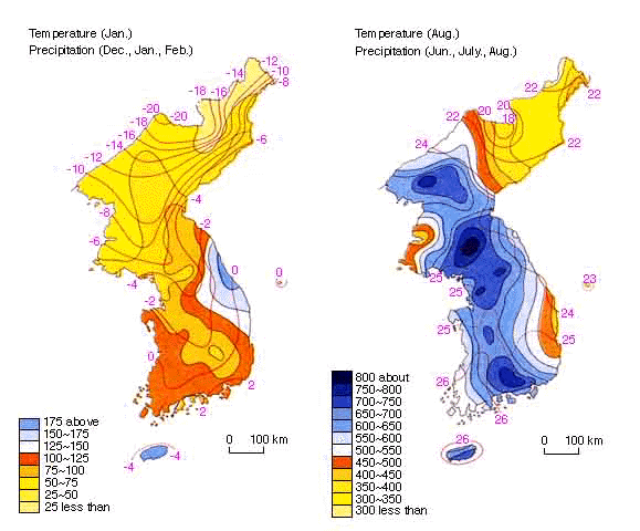
Current climate of South Korea. The temperatures are in Celsius, and precipitation is in millimeters. The heavier precipitation areas allow for paddy crops such as rice to be grown. The lesser precipitation areas allow for other crops.
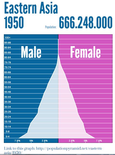
This is the population pyramid for Eastern Asia, which consists of Japan, the Koreas, and other countries. The website does not have North or South Korea, and the only country they have in that region is Japan. This is a population chart shortly after World War 2 and not long before the Korean War. As you can see, a huge part of the male and female population is younger than 30. A lot of this most likely has to do with the toll of wars in the region. The United States often refers to this time as the baby boom.
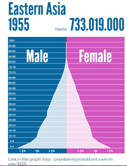
This is the population pyramid shortly after another war in the region, the Korean War. As you can see there is another baby boom in the area. This time there isn't a drop off until almost 40.
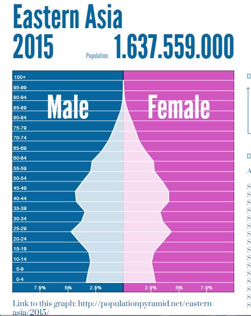
We compare the previous two pyramids to the current day. As you can see the largest percentages of men and women is right around 25-29 and 40-50 ranges. There have been no major conflicts, and some of the areas in Eastern Asia are actually having baby shortages as women are preferring work over having babies redefining what families are in some areas.
